Showing posts with label hike. Show all posts

Sunday, September 26, 2010

so I have been walking alot lately


And when I say a lot, I mean a lot. Last week I walked over 20 miles and this week I am on track to have walked even more. We will know at the end of today. So far, I have walked 4 days and 18.842 miles. I would love to walk at least 8 today. We shall see as it is very hot in these parts.

I walk many miles around my town. We have so many great walking trails and the city really has put a ton of time into creating and maintaining them. In fact, I just noticed the other day brand new signs at all the trail heads. These signs include a map, trail mileage, elevation, GPS coordinates, trail connections, and so much more.

new signs


I am a huge fan of my town. I just love it. Small town feel, best climate, national forest nearby, and beach 2 miles away.

Here are some recent pics from my daily walks.

Blenheim Farms


horses on a trail in the hills


roadrunner

Wednesday, September 8, 2010

attacked by gnats


I am officially behind on posting to this blog, but will catch up eventually I am sure.

Several weekends ago Kristi and I went hiking out in the San Mateo Wilderness area of the Cleveland National Forest. Even though it is summer here and it routinely runs over 100 degrees out in the wilderness this day was cool and around 75-80 degrees. Perfect!


The plan was to hike the Bear Canyon Trail to the Morgan Trail and back. Round trip it is about 10 miles.


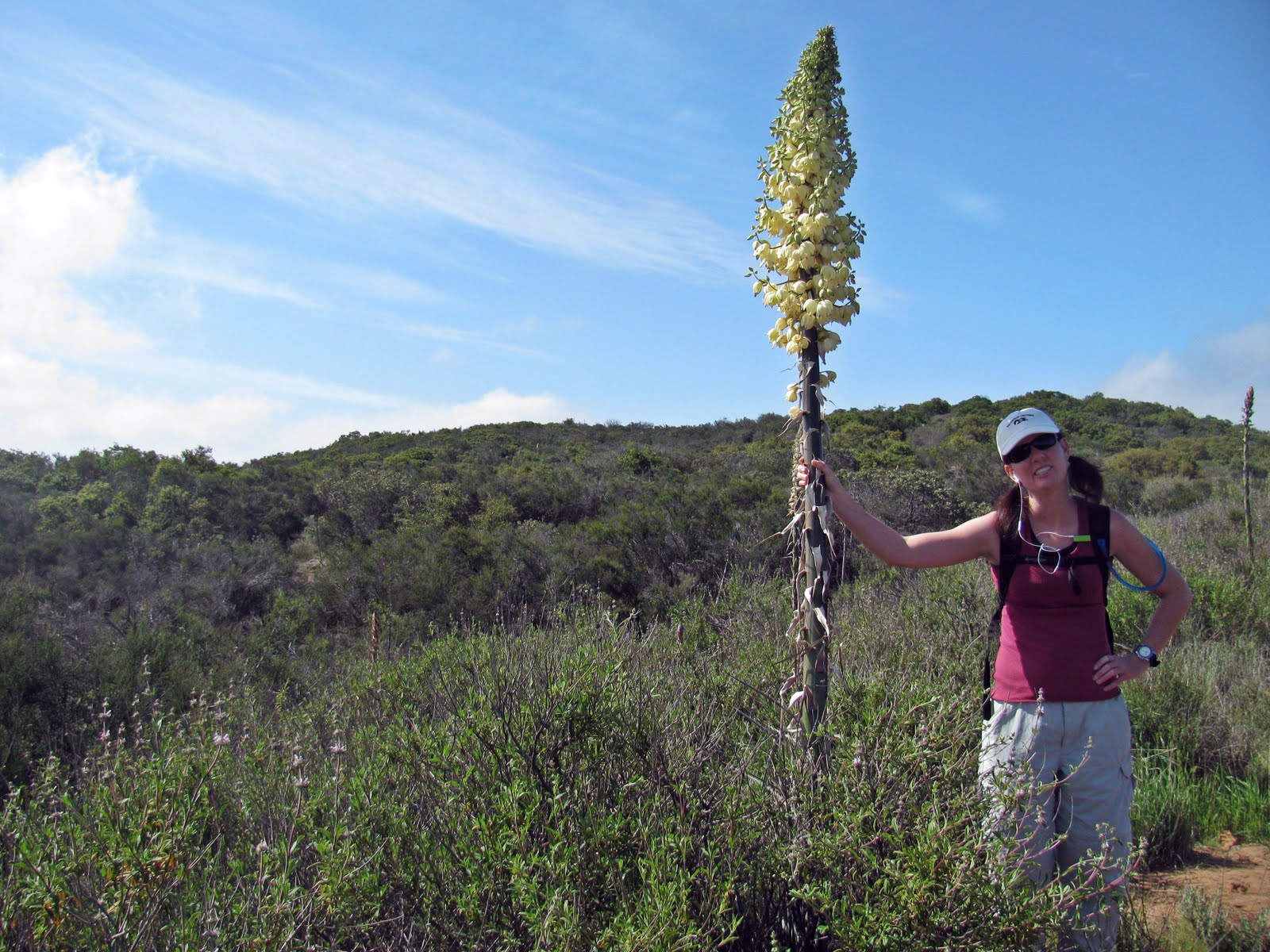
dead yucca


The hike was pleasant and quiet. We saw no other people on the trail. Most of the trail is a single-track and a steady climb from the side we started.

No snake sightings this time.

We did, however, spot some fresh mountain lion tracks and later when we heard a "large" animal near some oaks we definitely considered a lion (but, most likely a deer or other animal)


And no, we were not bothered by any large animals.

In fact, we were majorly annoyed by gnats.

The last 15 minutes of the first half of the hike, as we walked through a grassy, oak-lined area, the gnats began to harass and attack us in the most annoying way.

Honestly, we were swinging and flailing our arms like there was no tomorrow. This was the same time were heard the "large" animal in the bushes slightly uphill from us. We started to make lots of noise (just in case) and swing our arms like crazy people. Those bugs were in our noses, eyes, ears, you name it.


The gnats left us just before the end of the trail.

We survived, thank goodness. We ate our lunch at the Morgan Trail head and rested a bit.


looking east towards Lake Elsinore. Notice the smog. Yuck.


Then Kristi said the unthinkable. To summarize, she declared she would rather risk her life walking the Ortega Highway than go back through the gnats. So funny.

We are adventurers and taking a chance to get hit by a car is just part of adventure, I guess. :) (This is where Kristi says, "Oh, jeez.")

on the road again


We saw some new things, stopped at a day use area and looked at the California Wildland Firefighter Memorial. Interesting. Never knew it was there.


Next we walked down to El Cariso Village to stop at the Country Store. Lo and behold I ran into an old friend who bought the store. She informed us we were crazy to consider walking the road for the next three miles so her friend gave us a ride back to our car. Thank goodness for good Samaritans.


Then we had ice cream at the candy store to reward ourselves for surviving the gnats and Ortega Highway (not to mention a possible mountain lion.) "Oh, jeez."

It was a good time.

Tuesday, July 6, 2010

Crystal Cove State Park


Yesterday my sisters and I took a hike in Crystal Cove State Park, the Moro Canyon side, not the beach side.


We hiked approximately 6 miles with the first part of the hike up a steep incline with wonderful views from the top. The park is huge and we really only hiked a small portion.


Even though it is summer and it is July there was a terrific gloom settled over the coast which kept us cool. This made the hike much more enjoyable for sure. We did see plenty of people on the trails with it being a holiday weekend and all.

There were still plenty of wildflowers to be seen.

monkey flower


obligatory shoe shot (in first position, no less!)

Monday, June 14, 2010

barbara's lake hike


Do you know Orange County, CA actually has a few natural lakes? Two or three, I can't seem to get a straight answer, but there are at least two, or three, and they are located in the Laguna Coast Wilderness. Barbara is the largest of the three, or two, and is fed by a spring. No swimming or boating is allowed in this tiny lake, but it is nice to look at. I have lived here my entire life and never knew this lake existed until a few years back.


the lake


Well, we met our friends there for a play date/picnic/hike. The hike from the Nix Nature Center parking lot area to the lake is flat and very easy for small kids. It took us about 15-20 minutes to reach the lake. The hike can be longer depending on where you start and end.

obligatory shoe shot (we are looking at an ant carrying food)


The kids found many red ant dens? homes? holes? Whatever you call them. Several small beetles, not the stink kind, a grasshopper, and a plant that smells like peanut butter (do you know what this is called? I don't). Probably their favorite part was running up and down a dirt hill under the bridge.

the little ones are holding up the bridge


We spent two hours out on the trail, walking, exploring, running, eating snacks (of course). The best parts were the exercise, fresh air, views, happy kids, good conversation and the fact we barely saw anyone out there and, luckily, we did not see any snakes, either. I love uncrowded places.

Saturday, June 12, 2010

colinas bluffs trail


Look real hard in the above picture and you can see the Mission San Juan Capistrano. This trail is on the north side of SJC.

I am out of shape. I need to walk more, exercise more, do it all more. Kristi and I hiked the Colinas bluffs trail and it was good for me, but the hills were killer and I was truly lagging behind. Not to mention it was a HOT morning.

The views are spectacular. The Pacific Ocean can be seen at one point, views of the San Juan Valley, Cleveland National Forest, Saddleback Valley, and more. Look, our hills are already dried out. No more green hills.

FYI, this is my sister Kristi in the pictures.


She is always in my pictures since she NEVER brings her own camera anymore.

No pictures of me this time.

see the big hill in the background, see the little person hiking the big hill?


going up


view of the ocean

Thursday, April 22, 2010

sitton peak update: mini movie

Here is the mini movie I promised of the hike I took with my sister up Sitton Peak. Enjoy!

Tuesday, April 13, 2010

my first peak,Sitton


Happy 100th post.

Kristi and I hiked to the top of Sitton Peak in the San Mateo Wilderness of the Cleveland National Forest last Saturday. It was a very fun hike as the trails varied in vegetation and elevation. We made it to the Bear Canyon Loop Trail about 9 in the morning and we headed out. The trails are nicely maintained and the trail signs are easy to find.


Sitton Peak is sits at an elevation of 3273ft, but feels much higher once on top since the views are spectacular. We took Bear Canyon Trail to the Bear Ridge Trail to the four corners area and then followed the marker towards Sitton Peak. On the way back we took the Bear Canyon Trail from the four corners area back to Ortega Hwy. Round trip the hike was 10.3 miles with an elevation gain of 2100' and it took us 6 hours total.

The last part of the leg up to the Peak is a killer. Straight up we had to climb. It took us 40 minutes since we had to wait for other people to pass us coming down. I need to find out how much elevation gain is on the last part, because it was steep and strenuous. My legs were on fire!

Lunch at the top was awesome. My cool sister brought me lunch and the views were great all the way around. We stayed on top for about 30 minutes or so. Hiking down that incline Kristi and I found ourselves scooting on our behinds more than once since it was so slippery and steep. I could barely squat at the end. Even my toes hurt.


The hike back was warmer and Kristi and I were both walking a bit funny near the end. Kristi did a 10 miler the weekend before and she said this one was a bit more strenuous. We also realized there are many little uphill portions on the way back which we did not like. Doh!

As far as nature goes, it was just beautiful and peaceful out in the wilderness. We saw oaks, sycamores, a hawk, heard lots of birds, many lizards, a horned lizard, and a RATTLESNAKE! We were about a half mile to the end of our hike and on a single track. Kristi was in front and I was behind her. All of sudden a massively huge snake rattled his rattle at us in warning. We were about 10 feet away. Kristi jumped and we backed up slowly as those suckers can be fast. He was on a slope next to the trail and he had to be old because, again, he was HUGE. We let him saunter off and slowly approached, made sure he was gone, and took off. I think we kept expecting another snake to jump out at any minute since this part of the trail has slopes on each side so they could be close!

We made it out and treated ourselves to ice cream and candy at the candy store before heading home. Thanks to Brian and Ashley and their Hiking Blog! We read your posts to find a hike to do. Thanks for the information.


It was an awesome hike and I would do it again! I have a video in the works and will post soon.

Sunday, March 14, 2010

fremont canyon, have you seen this part of Orange County?


My sister, Kristi, and I signed up for a hike in the privately held land of the Irvine Ranch Conservancy. The hike was six miles, three up and three down. The first three miles were all up hill and it took us about two hours to get to the top. We gained about 1000 feet and the views were spectacular.

To start we drove to the back of Irvine Regional Park and then down a gated road a mile more. The Fremont staging area is right next to the Irvine Lake dam. It was interesting to see the back side of the lake as the damn has grass growing on it so it is nice and green instead of concrete looking. Right off the bat we walked next to a giant pile of coal that must have been there for 100 years. The coal is low grade and not very good. The surface mine at the top only was around for a short period in the late 1800s to early 1900s.

obligatory shoe shot in the "creek" crossing


uphill


Kristi hiking into the blue


yucca


coal deposits at the surface mine


looking down on the back side of Irvine Lake


wildflowers


Orange County weather station at the top


looking southeast


I recommend this hike for the views alone. Also, this time of year has got to be the best. A few months from now this will all be brown and showing the semi-arid state we live in. Enjoy!